top of page

Statewide 2021
Maps

Palmdale to Burbank Corridor
Where it began-Aug 2014

In-between March 2016

February 2022
Most Recent February 2022
Draft EIR - September 2022

Tunnel Detail 2017
The base map was obtained through a Public Records Request. The detail maps were produced by SAFE using the base map

Detailed Maps of Stonehurst/Sun Valley Area Produced by SAFE

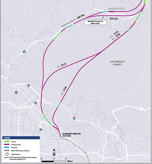
SR14 / E1

E2

Profile Maps 2016


Burbank to Los Angeles
Burbank Airport Area 2017
Note that Station Platform A is split between Sun Valley (Los Angeles) and Burbank

Geotechnical Testing Drill Sites Relative to Routes & 2016 Earthquake


Earthquakes as of 2008. Note that several moderate earthquakes occurred in this area after this map's rendering
San Gabriel National Monument is in the Path

Click image/logo on left to open map of San Gabriel National Monument

bottom of page